
Ward boundaries under review for 2022 election and beyond
John Cockburn
The boundaries of Ottawa’s 23 wards are being reviewed by an independent consultant team. Review must be done periodically to balance population numbers and achieve “effective representation,” as established by the Supreme Court of Canada and Ontario’s Local Planning Appeal Tribunal. Ottawa’s rapid growth has resulted in a population prediction of 1.15 million by 2026. This growth is occurring predominantly in suburban parts of the city, notably, Gloucester-South Nepean, Barrhaven and Cumberland. So far the project has included two rounds of public consultations—which became virtual because of COVID-19. On September 14 IMAGE joined a meagrely attended virtual consultation forum where six options for new boundaries were presented. Many of the options would result in significant change to much of Ottawa’s electoral boundary map especially for our Ward 12, Rideau/ Vanier.
The six options
One option severs Sandy Hill from Lower Town. Three others separate Sandy Hill and Vanier and add the portion of Somerset ward east of O’Connor to Sandy Hill. A fifth option includes Sandy Hill in a mega urban ward that extends west of Bronson Avenue. The first four options keep council close to its current 23 members. The fifth reduces the size of Council to 17 members. Option six reflects Sandy Hill’s existing ward boundaries more closely and still addresses the representational needs of a rapidly growing city, accomplishing this by allowing greater variance in ward populations—from 10 to 15 percent.
The right to vote
The boundary review is no small matter as the Canadian Charter of Rights and Freedoms guarantees citizens the “right to vote” with votes having similar weight.
A wide gap in the population size has emerged since the present 23 wards were drawn for the 2006 election. Currently, the population of the largest ward is double the size of the smallest ward. In between are several wards that are considerably larger or smaller than the average of all wards (43,804) in the 2018 election.
Information on the entire review, including a useful interactive mapping tool, is available at: ottawa.ca/en/city-hall/public-engagement/projects/ottawa-ward-boundary-review-2020.
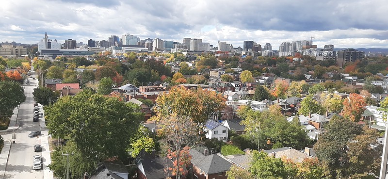
Photo Bob Whitelaw
Not just equal population
According to the City, one person’s vote should be of similar weight to another person’s. This suggests that wards should be of similar population. In practice, however, achieving effective representation involves balancing several considerations:
• Voter Parity: Ward populations should be similar but not identical, in the range of +/-10 per cent to +/-15 per cent of the average ward population.
• Natural/Physical Boundaries: Natural boundaries: rivers, the Greenbelt, and physical boundaries: highways, railways and arterial roads make good boundaries.
• Geographic Communities of Interest: Neighbourhoods such as the Glebe or Westboro Village and commercial areas such as the ByWard Market are “communities of interest.” Geographically contiguous communities of interest generally should not be divided.
• Minority Interests: Minority interests should be considered if they are geographically based.
• Ward History: Ward design should consider the history of the ward but should not override other major criteria.
• Capacity to Represent: This is often equated with Councillors’ workload. It includes matters such as ward sizes, types and complexity of issues, ongoing growth and development.
• Geographic Size and Shape: All wards cannot be the same geographic size.
• Population Growth: The results of the boundary review are meant to last for at least three municipal elections (2022, 2026 and 2030) and, perhaps, a fourth.
• Balancing the Components of Effective Representation: Voter parity, respecting communities of interest, and well-defined, coherent ward boundaries are the most important components.
Views from ASH
IMAGE reached out to Action Sandy Hill for its take on the options presented. President Susan Young was of the view that the population increases the consultants are working from are off. Ward 12 will grow a lot more than by 3,400 people by 2026. The new R4 rules will encourage density and Rideau Street is under intense residential development. She also felt that keeping our neighbourhood within its “natural” boundaries was important.
According to Young, the criterion on geographic communities of interest need to be broadened to reflect issues of common interest, so neighbourhoods with shared issues, such as heritage and the impacts of intensification, can be better defended. Are the issues that are important to Sandy Hillers—such as heritage, social and student issues—going to have the same resonance with a new set of co-electors? Diversity in neighbourhoods e.g. income, tenancy, was also considered to be important.
In the past there have been issues for which urban views have been under-represented. ASH suggests that there be more urban voices around the council table so we have more urban voices on committees whose decisions impact us most.
Complex issue
As you can see this is a complex issue that many councillors are grappling with. Councillor Fleury feels that the current approaches are too focused on population-based allocation. He states that “I am not favourable to any of the options proposed as they don’t consider all the important factors outside of population.” He feels that other demographic factors are more important and is especially concerned about workloads for councillors and their ability to deliver service and is following the consultations closely.
While unfortunately those consultations closed in September, decisions will not be made until December 2020. There still may be time to have a say in what your community should look like. We suggest you send your opinions on the options to Councillor Fleury for forwarding to the consulting team.
Examen des limites de quartiers : Quels changements pour la Côte-de-Sable ?
Résumé par Action Côte-de-Sable des options du point de vue de la Côte-de-Sable
Vous êtes peut-être au courant que la ville d’Ottawa revoit ses limites de quartiers. Voici un bref résumé des options élaborées par l’équipe de consultation. Lesquelles représentent le mieux les intérêts de la communauté de la Côte-de-Sable? La ville d’Ottawa met à votre disposition un site qui déborde d’information, incluant une carte interactive qui permet de comparer les options et les surimposer sur les limites existantes, les rapports de consultants, des documents de référence et bien plus encore. Vous les trouverez sur le site Examen des limites de quartiers d’Ottawa 2020 au https://ottawa.ca/fr/hotel-de-ville/engagement-du-public/projets/examen-des-limites-de-quartiers-dottawa-2020.
Notez que la Côte-de-Sable fait actuellement partie du Quartier 12, un quartier urbain qui devient Quartier 17 dans les options présentées ci-dessous. Parmi les aspects à considérer : si les quartiers urbains sont bien représentés par le nombre de conseillers municipaux qui leur sont alloués; si les diverses parties des quartiers partagent des intérêts similaires; si tout le quartier de la Côte-de-Sable reste intact, représenté par le même conseiller.
Option 1 (W1-17)
25 quartiers : 13 urbains, 9 suburbains, 3 ruraux
Dans cette option, la Côte-de-Sable et Overbrook font partie du même quartier. Strathcona Heights et le village Robinson sont séparés de la Côte-de-Sable, ainsi que la section du parc Strathcona qui les longe.
Les nouvelles limites s’étendent jusqu’au boulevard St-Laurent et à la promenade Aviation (est), à l’avenue Mann (sud), au canal Rideau (ouest), et aux rues Rideau/Montréal (nord).
Option 2 (W2-17)
24 quartiers : 12 urbains, 9 suburbains, 3 ruraux
Cette option regroupe la Côte-de-Sable, la Basse-ville, le Marché By, le Triangle d’or, et le centre-ville jusqu’à O’Connor. La Côte-de-Sable est intacte.
Les nouvelles limites sont bien définies (un des critères) par la 417 (sud), la rivière Rideau (est), la rivière des Outaouais (nord), et la rue O’Connor (ouest).
Cette option regroupe un secteur qui a plusieurs intérêts en commun dont le transport urbain, le tourisme, les bars et restaurants, les étudiants, les immeubles historiques et les maisons patrimoniales, etc.
Options 3 (W3-17) et 4 (W4-17)
En ce qui a trait à la Côte de Sable, les limites des quartiers sont identiques à l’option 2. La différence se trouve au nombre de quartiers, soit 23 quartiers dont 11 urbains, 9 suburbains, 3 ruraux.
Option 5 (W5-12)
17 quartiers : 9 urbains, 6 suburbains, 2 ruraux.
Cette option est très différente des autres options proposées et réduit le nombre de conseillers municipaux de manière importante. On propose 17 quartiers, plutôt que les 23 à 25 quartiers de la situation présente et des autres options. La Côte-de-Sable fait partie d’un « super » quartier du centre-ville qui s’étend de la rivière Rideau jusqu’aux plaines Lebreton.
Les enjeux partagés sont les mêmes que pour l’option 2, mais s’y ajoutent les divertissements, la Cité parlementaire, etc. Il est évident que le défi serait la représentation d’un si grand quartier comportant des intérêts si divers.
Option 6 (W6-17)
24 quartiers : 12 urbains, 9 suburbains, 3 ruraux
Dans cette option, la Côte-de-Sable garde ses limites actuelles. L’option 6 augmente le nombre total de quartiers de 23 à 24.
—Betsy Mann